Two stories from Caddie, Volume Two: Daniel Vigilante’s diary of four days on Royal Enfields, and Jack Carswell’s round at the Himalayan Golf Course, thirteen of its holes at the bottom of a river gorge. Here they are again, with the ground they cover.
The approach, on a map
The map needs WebGL. The cards carry everything it shows.
01 The approach
Eight of the world’s ten highest mountains
Nepal holds eight of the world’s ten highest mountains. Three of them stand on this map, each above 8,000 metres: Annapurna I, Dhaulagiri I and Manaslu.
- Annapurna I
- 8,091 m
- Dhaulagiri I
- 8,167 m
- Manaslu
- 8,163 m
02 Kathmandu to Pokhara
Twenty minutes, the Himalayas at eye level
From Kathmandu the crew flew west to Pokhara: 146 kilometres in a straight line, twenty minutes in “a plane not much bigger than a kid’s toy model”.
- Straight line
- 146 km
03 Pokhara
From the lake to the summit
Pokhara sits beside Phewa Lake at about 810 metres. 30.8 kilometres north, Machhapuchhre, the Fishtail, stands at 6,993 metres. “It photobombs every picture taken from the street.”
- Lakeside
- 810 m
- Machhapuchhre
- 6,993 m
- Between them
- 30.8 km
04 Four days on Royal Enfields
Pokhara, Bandipur, Chitwan, Tansen and home
The loop south and back on Royal Enfield Bullets: about 460 kilometres by the main roads between the towns, and some 4,700 metres of climbing.
- Day 1
- 77 km
- Day 2
- 86 km
- Day 3
- 171 km
- Day 4
- 126 km
05 The Himalayan Golf Course
Down in the gorge of the Bijaypur
9 kilometres east of Lakeside the Bijaypur River has cut a gorge some 74 metres deep. Thirteen of the course’s eighteen holes are down in it.
- River
- 682 m
- Rim
- 756 m
- Depth
- 74 m · 243 ft
Chapter I
The Road Diaries
Dangerman Daniel Vigilante on surviving death, rebel life and missed connections on the great Himalayan road.
Words by Daniel Vigilante · Photography by Dave Carswell, Sam Cooke & William Watt
My trip to Nepal started like it ended – with airport dramas. A missed flight connection forced me to spend the night in Guangzhou, China, until the next flight to Kathmandu, a full day later. The annoyance, however, came with a silver lining: I got put up in a 5-star hotel of my choice, an upper-middle class micro-holiday, which I – as someone who bought the cheapest flight they could find – probably didn’t deserve. So I wasn’t complaining. Much.
Landing in Kathmandu later than planned meant my two days in the capital became little more than another layover. More logistical dramas reduced it further – the taxi couldn’t find my hostel so I lost another two hours in a bicycle rickshaw searching for it.


The next day we flew to Pokhara in a plane not much bigger than a kid’s toy model. The 20-minute flight provided a breathtaking view of the Himalayas, which were at eye level and kept me distracted from the terrifying ordeal that any rational person would otherwise feel in a toy plane.
Pokhara is the second largest city in Nepal, but to most tourists who stay in and don’t leave Lakeside (the tourist district) it feels like a charming little town. Situated in a valley beside Phewa Lake, the mountains rise very quickly, and within 30 kilometres the elevation rises from 1000 to 7500 metres. The most striking peak you can see from Pokhara is Machhapuchhre, or ‘Fishtail’ Mountain, and it photobombs every picture taken from the street. Pokhara is a mountaineering hub (it’s the base for the famous Annapurna Circuit trek) and a beacon to the outdoorsy traveller. Here you can hike, raft, bungee, paraglide, play golf at one of the most scenic courses in Asia, and of course, ride motorbikes.

Lakeside to Machhapuchhre: 810 m to 6,993 m in 30.8 km
A straight line north from Lakeside to the Fishtail's summit. The terrain model smooths the summit to about 6,860 m; its surveyed height is 6,993 m.
The numbers
| Distance | Elevation (m) |
|---|---|
| 0 km | 810 |
| 2 km | 1,156 |
| 4 km | 960 |
| 6 km | 1,025 |
| 8 km | 1,133 |
| 10 km | 1,097 |
| 12 km | 1,293 |
| 14 km | 1,456 |
| 16 km | 1,597 |
| 18 km | 2,336 |
| 20 km | 2,500 |
| 22 km | 3,440 |
| 24 km | 4,102 |
| 26 km | 4,090 |
| 28 km | 4,710 |
| 30 km | 5,977 |
| 31 km | 6,863 |
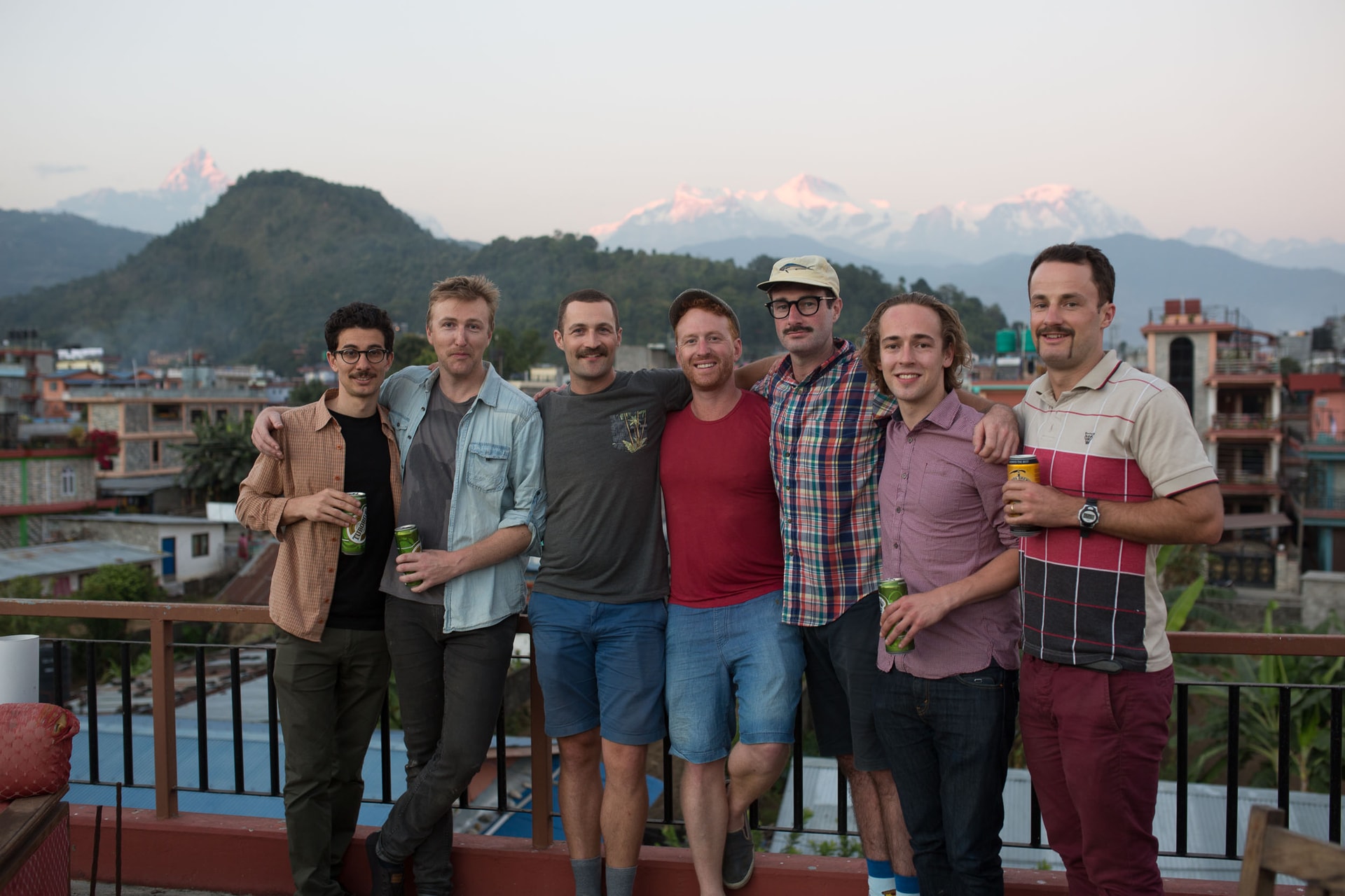
Our crew – six Aussie wannabe rebels from a variety of walks of life, living in six different cities across three different countries – met up here to ride motorbikes and play golf. The motorbiking aspect was courtesy of Hearts and Tears Motorcycle Club, a business based in Pokhara that runs group motorbike tours primarily on Royal Enfield Bullets – the world’s longest-living and arguably most handsome motorcycles. Originally British made and owned, and brought to India during Crown rule, the bikes have been wholly Indian made and owned since 1949, and still look incredible.
Hearts and Tears is owned and run by Matt, an Aussie friend I met as a fellow exchange student in Mexico City a decade ago. Hearts and Tears has grown to become one of the finest motorcycle tour companies in Asia, with spectacular tours on offer for beginners right up to biking aficionados. Three of us in the group were definitely in the novice skill range, having barely any motorcycling experience (one got up early and had a two hour lesson on the morning that we were leaving). The fact that all bikes were manual only added to the challenge.


We started out from Pokhara on day one and headed to Bandipur, about 80kms south. The newbies were fairly cautious on their big new toys and there was some wobbly handling and a number of stalled starts. But riding a motorised bike is a bit like riding a bicycle – once you’ve got it, you’ve got it. The learning curve was steep and it wasn’t long before we were outmuscling the locals on scooters and asserting our place in the road hierarchy. Steppenwolf’s Born To Be Wild became the soundtrack to the afternoon, in my head anyway.
Day one
Pokhara to Bandipur
- By road
- 77 km
- Climbing
- 1,020 m
- High point
- 1,007 m
Elevation, Pokhara to Bandipur
The numbers
| Distance | Elevation (m) |
|---|---|
| 0 km | 807 |
| 8 km | 798 |
| 16 km | 665 |
| 24 km | 524 |
| 32 km | 476 |
| 40 km | 508 |
| 48 km | 453 |
| 56 km | 367 |
| 64 km | 607 |
| 72 km | 692 |
| 76 km | 1,007 |
| 77 km | 993 |
We made it to Bandipur by late afternoon: a quaint hilltop town along a mountain saddle just 200m long and barely wide enough to accommodate a strip of buildings on either side of the main street. The last 8km of the road to Bandipur ascends 1000 metres, making it a challenging, winding incline which, I regret to admit, I stalled on in full view of the crew, began to roll backwards, and lost all the riding credit I thought I was building.
Our accommodation in Bandipur was a beautifully restored old-style inn with dark wooden detailing, smoky old bricks and low ceilings. It felt a bit Dickensian, except it had Wi-Fi. We enjoyed a few well-earned beers and reminisced on the day’s ride, patting ourselves on the back for surviving. We were served a feast of house roasted pork, potato and gravy and retired by 9pm due to sheer exhaustion.


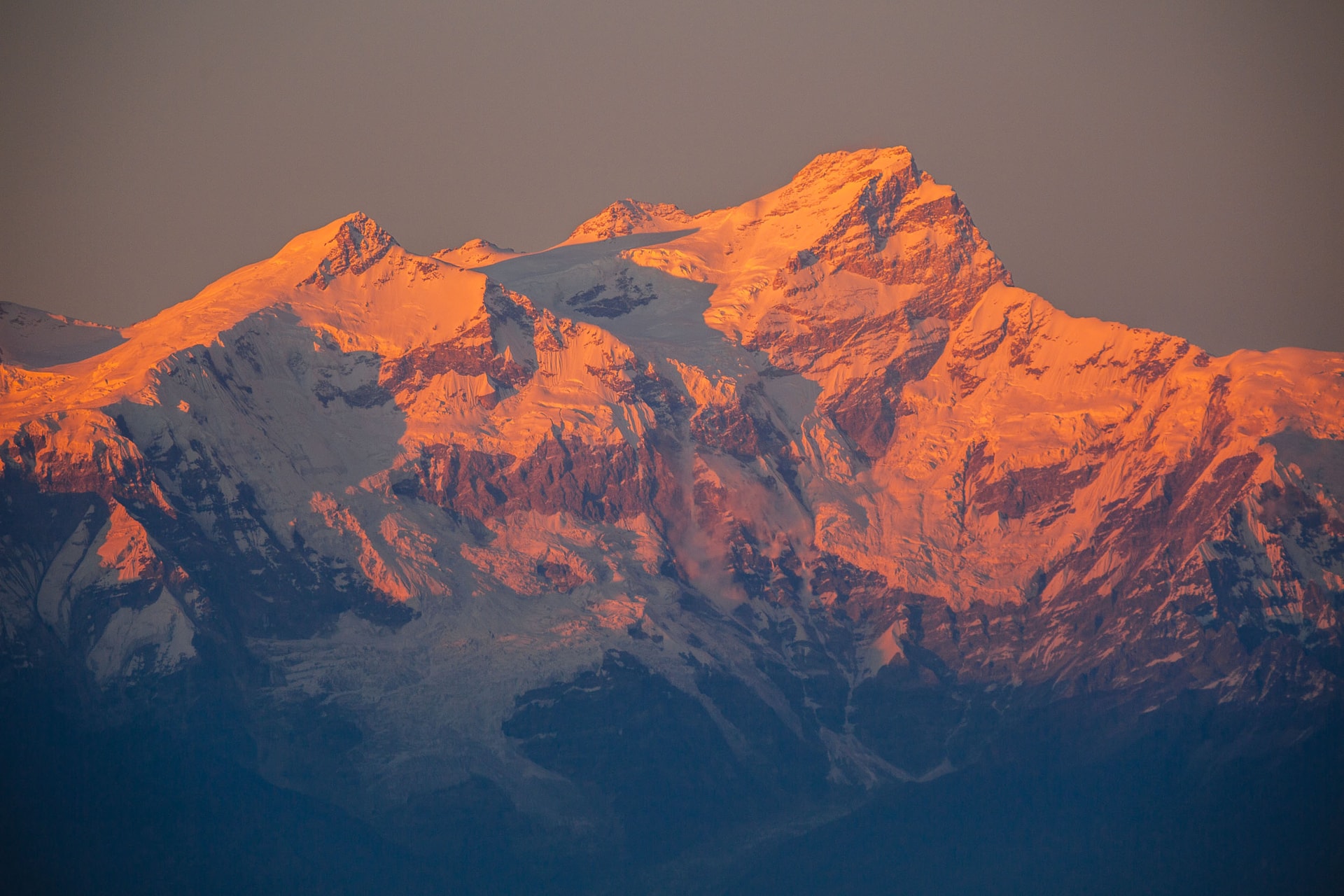
The pre-dawn ride the next morning rewarded us with one of the best sunrises you’re ever likely to see, gaining a brilliant vantage point overlooking the Dhaulagiri and Annapurna mountain ranges. It put everyone in a good mood for the ride ahead.


Day two saw us head for Chitwan National Park, Nepal’s oldest national park and – as the brochures will tell you – home to the Bengal Tiger. The ride itself was one of the most grueling as there was a long stretch of extremely bumpy and dusty gravel road populated by big ugly trucks, roadworks and boulders. It was a hellish section but it made the cold beer upon arrival at our safari accommodation all the more satisfying. The guided forest walk we took through the Tikauli Jungle didn’t show any tigers but we did see a few rhinos, which justified the price of the ticket. Our accommodation boasted wild elephants roaming free behind the property. The food in the evening, as always, was fit for a motorcycle gang.
Day two
Bandipur to Chitwan National Park
- By road
- 86 km
- Climbing
- 330 m
- High point
- 1,013 m
Elevation, Bandipur to Chitwan National Park
The numbers
| Distance | Elevation (m) |
|---|---|
| 0 km | 993 |
| 1 km | 1,013 |
| 9 km | 418 |
| 18 km | 366 |
| 27 km | 310 |
| 36 km | 304 |
| 45 km | 244 |
| 54 km | 236 |
| 63 km | 285 |
| 72 km | 210 |
| 81 km | 203 |
| 86 km | 189 |
Day three was the longest ride: 160kms to a town called Tansen. After another ultra-scenic lunch stop, the late afternoon ride was one of the best: a lively exploration through a labyrinth of small alleyways, and the loud roar of the bikes attracted everyone’s attention. Sunset fell for the final 10kms along a ridgetop, a stretch memorable for its colour and pastoral serenity. We spent the evening at an organic farm nestled in a quaint valley and were served the world’s tastiest smoked bacon, among other things, before retiring beside a hearty fire. The morning revealed the real charms of this rustic farmhouse and, after a smashing breakfast with the leftover bacon, we were all a little sad to leave knowing it would be our last day looking tough on a bike.

Day three
Chitwan National Park to Tansen
- By road
- 171 km
- Climbing
- 1,940 m
- High point
- 1,296 m
Elevation, Chitwan National Park to Tansen
The numbers
| Distance | Elevation (m) |
|---|---|
| 0 km | 189 |
| 18 km | 194 |
| 36 km | 190 |
| 54 km | 179 |
| 72 km | 196 |
| 90 km | 393 |
| 108 km | 130 |
| 126 km | 145 |
| 144 km | 339 |
| 162 km | 819 |
| 171 km | 1,296 |

The ride from Tansen back to Pokhara was probably the most fun, as by this stage we were all utter pros on the bike (if I do say so). The winding road through the luscious ‘dragon’s tail’ hillside was almost desolate, perfect for the mad dog bikers we had become. When we finally came roaring back into Pokhara Lakeside, the beaming smile on all of our faces was hard to shake. The relief at not dying was palpable and manifested in a drinking binge by the lake, where we talked through and embellished the highlights.
Day four
Tansen to Pokhara
- By road
- 126 km
- Climbing
- 1,410 m
- High point
- 1,296 m
Elevation, Tansen to Pokhara
The numbers
| Distance | Elevation (m) |
|---|---|
| 0 km | 1,296 |
| 13 km | 1,083 |
| 26 km | 442 |
| 39 km | 660 |
| 52 km | 743 |
| 65 km | 760 |
| 78 km | 961 |
| 91 km | 955 |
| 104 km | 1,092 |
| 117 km | 849 |
| 126 km | 807 |
The relief at not dying was palpable and manifested in a drinking binge by the lake.


The next few days in Pokhara were spent recovering, reflecting, playing golf, and buying pashminas and handwoven rugs. One last overnight hike to the aptly named Australia Camp brought another surreal sunrise, and I began to convince myself that perhaps I could become a morning person. The gang disbanded over the next 24 hours, and after some more airport dramas, which nearly broke my spirit, I finally made it home. My heavily pregnant wife gave birth a few weeks later, and we all lived to tell the tale. Just don’t tell her I came off the bike twice.


Chapter II
Golf on Top of the World
Jack Carswell leaves no green unturned by the buffalos, snow-fed rivers and incredible vistas of Nepal's Himalayan Golf Course.
Words by Jack Carswell · Photography by Dave Carswell, Sam Cooke & William Watt
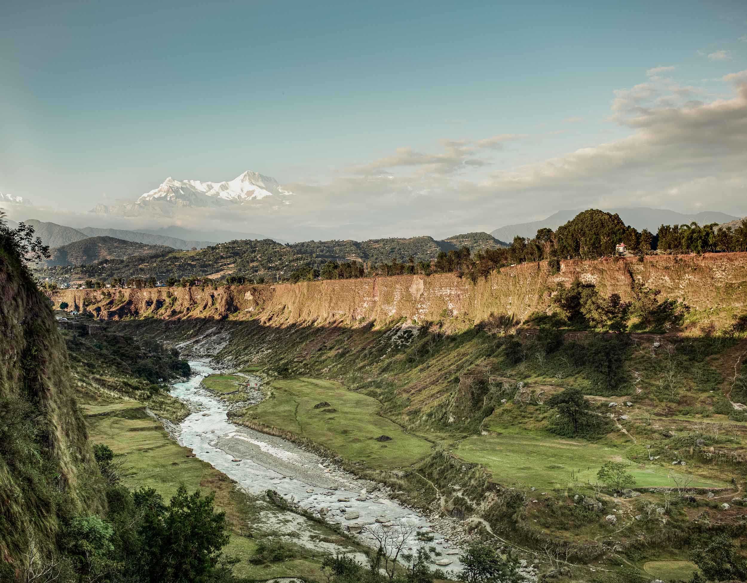
Amidst the foothills of the Annapurna ranges and nestled within the gorge of the Bijaypur River sits one of the most unique and awe-inspiring golf challenges in the world. The Himalayan Golf Club may be a relative newcomer to golf, but it has quickly cemented the title as one of the most unique courses found anywhere. Designed and constructed by ex-British Army Commissioned Officer Major Ram Bahadur Gurung and opened in 1998, the 18-hole layout features the extreme elevation changes one might expect of a golf course in a country hosting eight of the world’s ten highest mountains.


Originally envisioned as a 9-hole layout restricted by land, Major Ram gradually added hole by hole to fully encompass 18 holes, 13 of which sit 250 feet below the clubhouse in the river canyon. This has been facilitated by a number of shared fairways reminiscent of early Scottish architecture, including a repeat of holes 1 and 2, as 17 and 18 respectively. It’s evident from the outset that minimal earth moving has taken place in this remote location, largely by necessity; but this proves true to the notion that nature provides a more enduring challenge than money can.
Across the gorge: the river 74 m (243 ft) below the rim
The ground on a 1.4 km line through the course, square to the river. The rule sits 250 feet below the lower rim, where the story puts the canyon holes.
The numbers
| Distance | Elevation (m) | Elevation (ft) |
|---|---|---|
| 0 m | 755 | 2,477 |
| 100 m | 755 | 2,477 |
| 200 m | 755 | 2,477 |
| 300 m | 756 | 2,480 |
| 400 m | 754 | 2,474 |
| 500 m | 747 | 2,451 |
| 600 m | 713 | 2,339 |
| 700 m | 685 | 2,247 |
| 720 m | 682 | 2,238 |
| 800 m | 697 | 2,287 |
| 900 m | 758 | 2,487 |
| 1,000 m | 759 | 2,490 |
| 1,100 m | 759 | 2,490 |
| 1,200 m | 756 | 2,480 |
| 1,300 m | 756 | 2,480 |
| 1,398 m | 759 | 2,490 |
Holes 1 and 2 take advantage of the small parcel of land available between the clubhouse and mothballed resort construction that flank the entrance drive. While not overly inspiring, they provide a somewhat safeguarded introduction to Nepalese golf, with thick Paspalum grass varieties and discrete well-placed hazards making a pair of pars to start with more than acceptable. The transition from the cliff top to the canyon is dramatically presented with the 3rd tee shot of the round: the drive shoots up into the Annapurna ranges before dropping for over ten seconds of hang time to a narrow fairway 200 feet below. Depth perception becomes critical as you plan your approach to the 3rd green, with anything over length falling victim to the snow-fed river. The front of this green, as with many here, is protected from the fairway maintenance herds by barbed wire fencing, reminiscent of the recently restored Ratho Farm in Tasmania, Australia’s oldest operating golf course.


From here the course provides a sturdy test of the golfer’s concentration and shot-making ability, as each hole is carved from the original landscape by thousands of years of erosion, creating varying elevations from tee to green, hole to hole. Making use of a naturally occurring island within the Bijaypur River, the course designer has created the signature 6th, a 500 yard par-5 with two separate river crossings to reach the island green. If the 14th of St Andrews Old met with the 17th of TPC Sawgrass (the course in Ponte Vedra Beach, Florida, home to the annual PGA Players Championship), this would be the result. Believed to be the only island green in the world surrounded by a naturally flowing river, both the tee and green are separated to the west of the fairway by water, creating a tantalising opportunity to reach the island green in two shots for the brave or stupid. Two rows of pot bunkers located within the green complex line the approach area, encouraging the more conservative route of laying up to the right of the river to leave a short iron across the ice cold water.


Nature provides a more enduring challenge than money can.
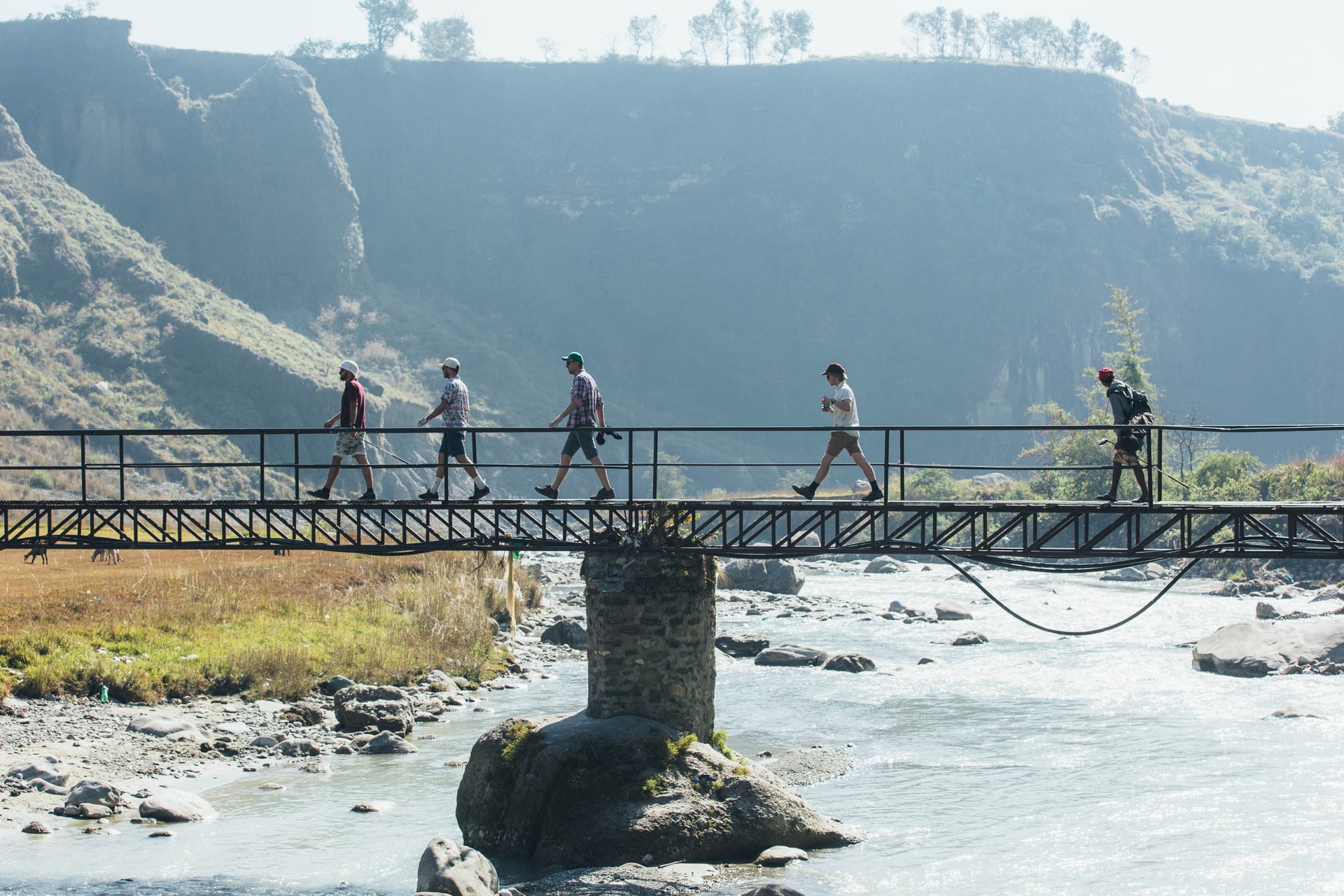
The majority of the back 9 meanders back and forth across the river, and every hole offers a quirk or two. Blind approaches over plateaus, cliff top greens, rickety bridges, locals picnicking, buffalo swimming – as with the rest of Nepal, there’s always something to surprise. During our visit, a ragtag crew of local caddies, ball spotters and curious kids meant that there were about a dozen of us navigating the course at times during the round. At 34°C with little breeze, everyone was feeling the heat in the valley as we neared the end of the loop. At the 12th hole we realised we were low on water and golf balls, but our caddies quickly located a mountain stream with fresh water to fill our bottles, as well as a backup supply of balls at $1 each (we churned through most of those as well).



The final challenge of the course is traversing back up the cliff face to the par-3 16th. At only 160 yards, one can be forgiven for taking an extra club to avoid leaving it short or right of the green, from where a 200 foot plummet awaits. From the tee it’s not immediately obvious where the green is located – to the amusement of the caddies and the bemusement of the rest of the group, our first player launched one back down into the valley, thinking the green was from where we had just come.


There was “no fucking way” we were hiking back down into the valley, having just ascended back to ground level. In fact only the most hardy golfers will be keen to replay holes 1 and 2 for the 17th and 18th; after surviving the challenging 16th tee shot, the general feeling in our group was that handshakes were due and beer o’clock had arrived.
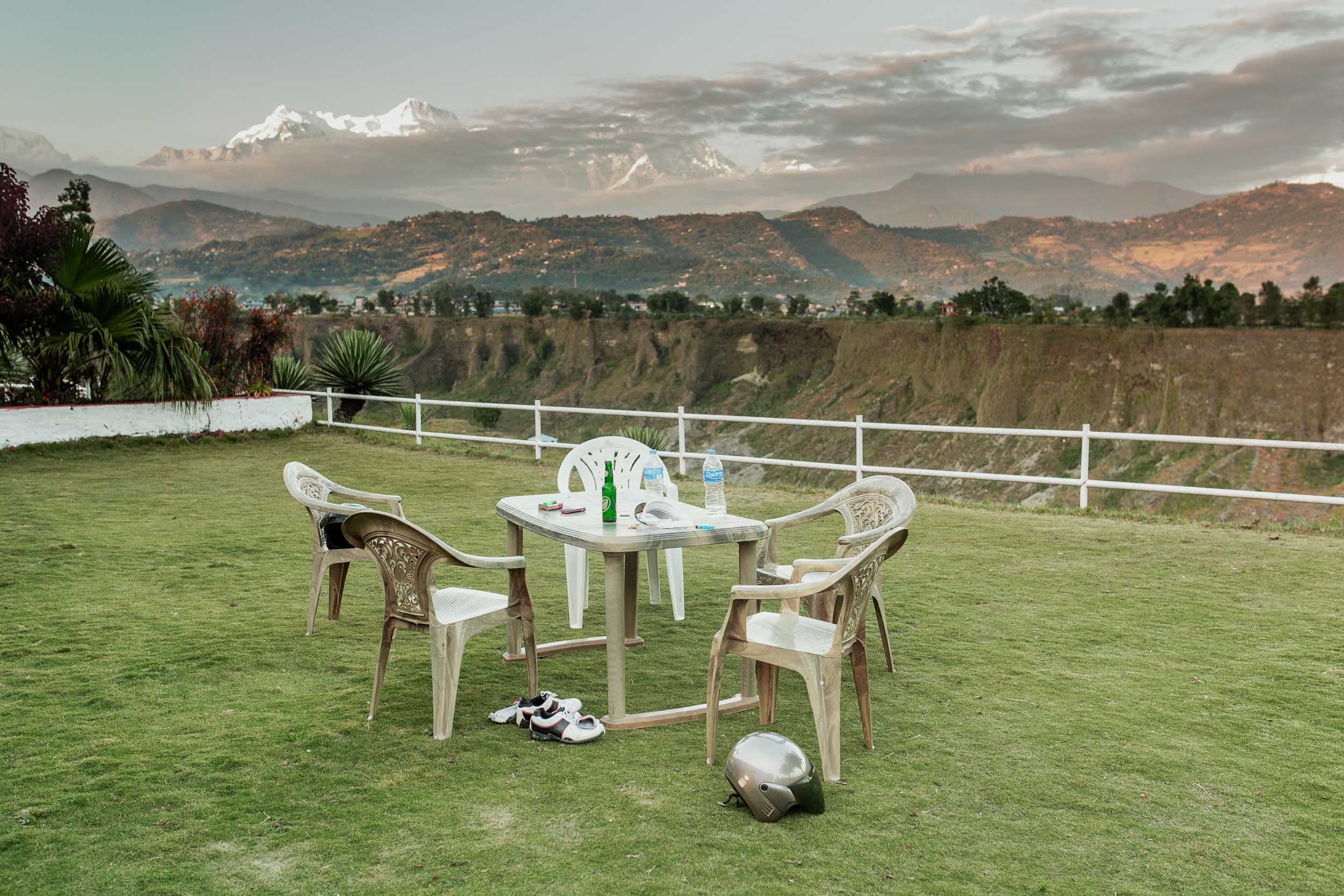
No great golf course is complete without a well-equipped 19th, and the Himalayan Golf Club meets all the criteria. Set atop a cliff overlooking the course and mountain ranges, the clubhouse provides a spectacular backdrop to a well-earned Sherpa (Nepal’s best beer as judged by us), which can be enjoyed alongside the current Chairman of the club, Bhuwan Gurung. If you feel as though you left a shot or two on the course, Bhuwan enjoys nothing more than the challenge of hitting the 6th green from the 3rd tee, only a stone’s throw from the bar.




A course (literally) above all, the Himalayan golf experience is a timely reminder that golf in its purest and simplest form – without neatly manicured or tightly cut fairways and greens – can provide both a challenging and enjoyable test of skill and determination uncommon in the modern golfing world.
More from the road and the gorge